


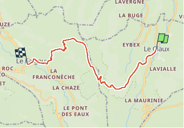
G400 Le Claux Le FallGoux

taguette
User

Length
13.1 km

Max alt
1552 m

Uphill gradient
553 m
Km-Effort
21 km

Min alt
888 m

Downhill gradient
703 m
Boucle
No
Creation date :
2024-08-26 08:40:51.798
Updated on :
2024-08-26 13:38:31.635
4h47
Difficulty : Very difficult

FREE GPS app for hiking
 SityTrail
IGN / Geographical institutes
SityTrail Plus
The world is yours!
About
Trail Walking of 13.1 km to be discovered at Auvergne-Rhône-Alpes, Cantal, Le Claux. This trail is proposed by taguette.
Positioning
Country:
France
Region :
Auvergne-Rhône-Alpes
Department/Province :
Cantal
Municipality :
Le Claux
Location:
Unknown
Start:(Dec)
Start:(UTM)
476895 ; 5000770 (31T) N.
Comments